Complexity

Battle Damage Assessment based on Satellite Images

Assessing the amount of damage onboard of a military vehicle has been shown using the QCM in one of our blogs. This short article shows how a similar approach can be applied to areas affected by military operations, not just equipment.

We consider an area, shown below, that has been subjected to air strikes and analyze the complexity of satellite images of the same area before and after the said strikes. Based on image complexity, the amount of damage inflicted is around 87%.

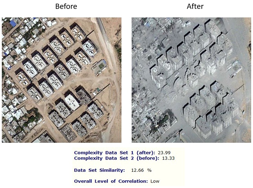
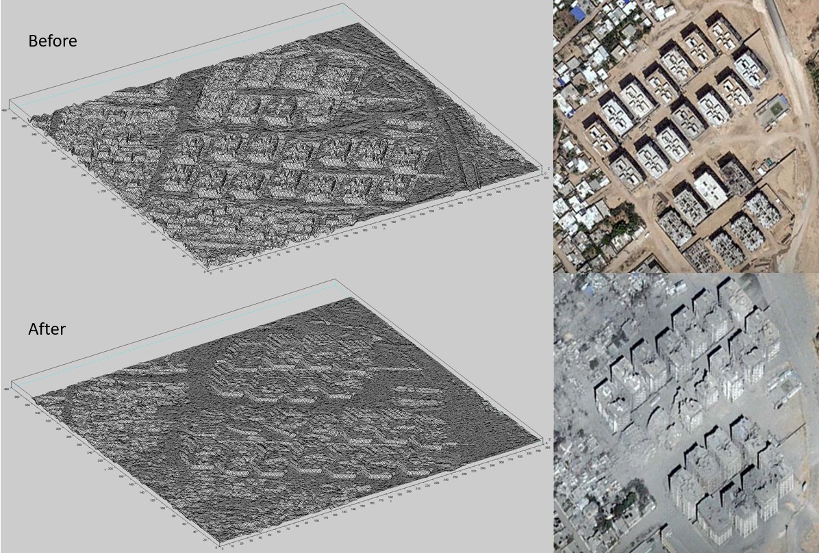
The original satellite images are transformed using a proprietary technique before QCM processing, as shown below.

The degree of inflicted damage is equal to 100% minus data similarity, in this case, 100% – 12.66% = 87.3%. This is of course a coarse measure and closer inspection on the ground may be needed to provide a more specific assessment.

Unknown's avatar

Established originally in 2005 in the USA, Ontonix is a technology company headquartered in Como, Italy. The unusual technology and solutions developed by Ontonix focus on countering what most threatens safety, advanced products, critical infrastructures, or IT network security - the rapid growth of complexity. In 2007 the company received recognition by being selected as Gartner's Cool Vendor. What makes Ontonix different from all those companies and research centers who claim to manage complexity is that we have a complexity metric. This means that we MEASURE complexity. We detect anomalies in complex defense systems without using Machine Learning for one very good reason: our clients don’t have the luxury of multiple examples of failures necessary to teach software to recognize them. We identify anomalies without having seen them before. Sometimes, you must get it right the first and only time!

0 comments on “Battle Damage Assessment based on Satellite Images

Leave a comment